
CAQM to re-test burnt-area protocol as data diverge
India's CAQM will re-test its burnt-area protocol amid divergence between satellite readings and ground verifications in Punjab and Haryana, with ISRO NRSC collaboration planned for the upcoming Kharif season.
Key takeaways
- CAQM will re-test its burnt-area protocol due to gaps between satellite data and on-ground verification in Punjab and Haryana.
- The protocol relies on MIRBI using Sentinel-2 data at 20m x 20m resolution with 5-7 day intervals.
- Ground truthing from the 2025 Kharif and 2026 Rabi seasons is being used to assess satellite mappings and improve accuracy.
What Happened
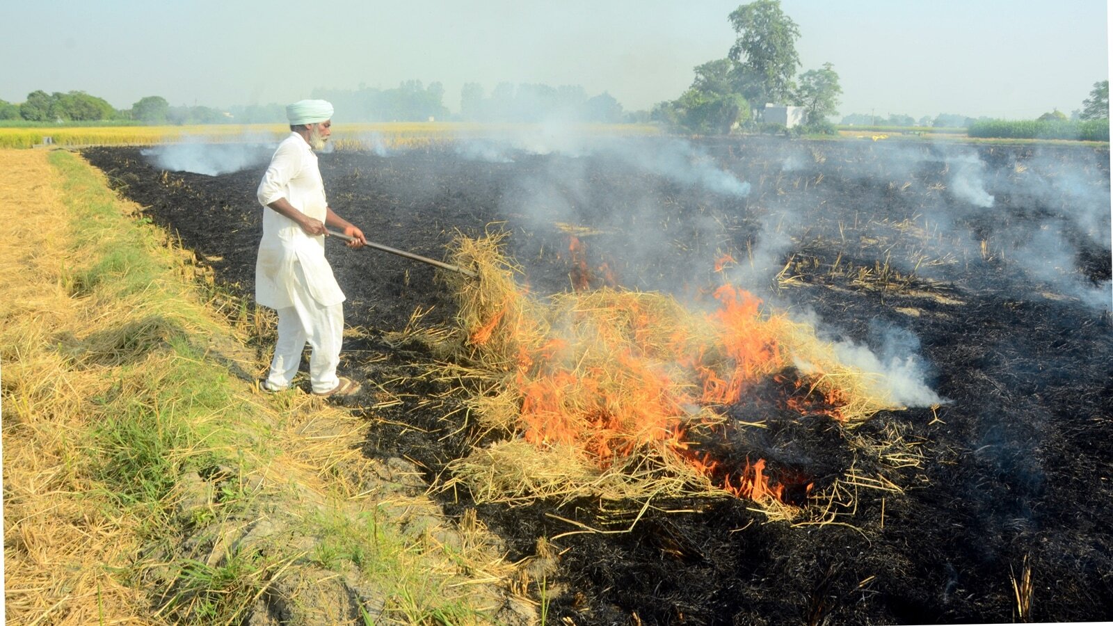
The Commission for Air Quality Management (CAQM) has not yet validated its burnt-area assessment protocol due to notable divergence between satellite-derived mappings and on-ground verification for the states of Punjab and Haryana. In response, CAQM and the National Remote Sensing Centre (NRSC), which operates under the Indian Space Research Organisation (ISRO), plan to re-test the protocol during the forthcoming Kharif harvest season. This effort follows an RTI exchange and statements from CAQM officials indicating that ground-truthing is being incorporated to improve the accuracy of satellite-based burnt-area estimates. Ground truthing for the 2025 Kharif and 2026 Rabi seasons has been carried out to compare against satellite mappings, with CAQM officials highlighting the goal of enhancing emission understanding and enforcement actions through improved methods.
The burnt-area assessment protocol was developed by NRSC and ISRO, with contributions from the Indian Agricultural Research Institute (IARI) and Punjab and Haryana’s State Remote Sensing Centres. The methodology uses data from the European Space Agency’s Sentinel-2 and applies a Mid-Infrared Burn Index (MIRBI) to identify burnt patches at a 20 meter by 20 meter resolution, with mappings produced at 5- to 7-day intervals. The approach aims to align satellite estimates with field data to support monitoring and enforcement programs.
Officials noted that, since 2024, there has been scrutiny over undercounting fires due to limitations in satellite overpass windows. The burnt-area mapping protocol has been used to fill gaps left by satellite timing, but ground truthing revealed discrepancies in recent seasons. CAQM indicated that, once the methodology is robustly established, it could strengthen future action plans and enforcement. The agency also stated it is in discussions with ISRO to improve ground-truthing protocols.
Why It Matters
Paddy stubble burning during September 15 to November 30 is a major contributor to air pollution in the Delhi-NCR region. On certain days in October or November, emissions from farm fires have been reported to account for as much as 35% of pollution. The reliability of burnt-area data directly influences how emissions from crop-residue burning are estimated and how enforcement actions are designed. Improving alignment between satellite readings and ground observations could sharpen policy responses and targeting of corrective measures during peak burning periods.
The effort to re-test the protocol, and to enhance ground-truthing collaboration with ISRO and NRSC, reflects an ongoing attempt to reduce uncertainties in monitoring crop residue fires. If validated, the protocol could become a more consistent tool for calibrating emissions estimates and informing planning for mitigation during high-pollution episodes linked to agricultural burning.
Background
CAQM monitors active fire counts in collaboration with bodies under the Agriculture Ministry to assess the scale of stubble burning. The burnt-area protocol was developed with inputs from ISRO, NRSC, IARI, and state remote-sensing centres in Punjab and Haryana, using Sentinel-2 data. The use of MIRBI at a 20m x 20m spatial resolution enables detailed mapping at short intervals, which is intended to support alignment with satellite-based estimates of crop residue burning. Ground truthing in 2025 and 2026 seasons has been part of validating this approach, and the CAQM is exploring improved ground-truthing protocols in partnership with ISRO.
There has been judicial attention to undercounting fires due to satellite overpass windows, with concerns raised since 2024. The protocol’s validation and subsequent adjustments could influence how monitoring data informs enforcement actions and policy decisions related to crop residue management and air-quality controls in northern India.
Key Facts
- The CAQM has not validated its burnt-area assessment protocol due to divergence between satellite and ground verification data for Punjab and Haryana.
- CAQM and NRSC/ISRO plan to re-test the protocol during the upcoming Kharif harvest season.
- Ground truthing of burnt areas was conducted for the 2025 Kharif and 2026 Rabi seasons to compare with satellite mappings.
- The protocol uses MIRBI to detect burnt areas at 20m x 20m resolution with 5–7 day intervals, based on Sentinel-2 data from ESA.
- Under-counting concerns related to satellite overpass windows have been a point of scrutiny since 2024, including in the Supreme Court process.
- Paddy stubble burning during Sep 15–Nov 30 is a major pollution source for Delhi-NCR, with emissions on some days potentially contributing up to 35% of total pollution.
- The burnt-area assessment protocol was developed by NRSC/ISRO with IARI and Punjab & Haryana State Remote Sensing Centres.
- Officials said improving the methodology could strengthen future action plans and enforcement actions.
What Happens Next
CAQM and ISRO-linked bodies intend to conduct additional testing of the burnt-area protocol during the next crop season (Kharif), with further emphasis on enhanced ground truthing to reconcile satellite measurements with ground data. The objective is to produce a more reliable assessment of burnt areas to inform enforcement and policy measures tied to crop-residue burning in the region.
Sources reviewed
Project Chintan independently synthesized and analyzed information cross-checked across the sources listed above.
Related stories

Gold Rates Today: 24K, 22K, 18K prices across Indian cities on Sep 1
MP to test fuel access ban for uninsured vehicles in pilot district

Patnaik calls for reversal of MMDR amendment, calls it black day for Odisha
